EASY Walk - Birnie & Gaddon Lochs
2 Feb 21
20 MIN READ TIME
05 May 23
History & heritage
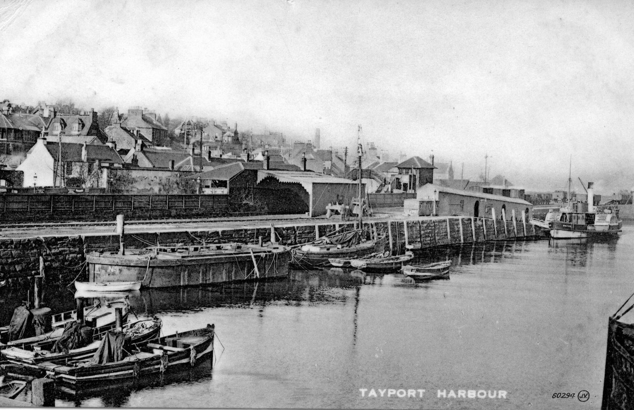
image above: Mussel boat moorings and passenger ferry Dolphin with railway station on left
Tayport is a town in the north east of Fife, on the south edge of the River Tay, with a long and rich history.
Formerly known as Ferry-Port on Craig, in the 11th century, pilgrims from St Andrews travelled to this coastal hamlet to be ferried across the Tay and continue their pilgrimage to Arbroath Abbey. Centuries later, ferries were still making the trip across the estuary, carrying travellers and even railway wagons, a service which continued until the Tay Rail Bridge opened in 1878.
Today, Tayport Harbour is largely a marina, with yachts and small boats berthed at the jetties - perfect for photos. As you wander round the harbour, keep an eye on the Tay. A large pod of bottlenose dolphins visit the estuary in the summer and they often make an appearance close to the harbour entrance, especially on summer evenings.
Tayport Heritage Trail will take you on a tour of the town and explain the history along the way at 24 information boards.
There's lots of interesting history on the trail, we've put together a taste of what you'll discover. For lots more information on the trail and Tayport visit the website
1 The Ferry, Harbour and Railway

image: The Dolphin passenger ferry
There has been a river crossing from Tayport (also formerly known as South Ferry of Portincraig, East Ferry, and Ferry-Port-on-Craig) for many centuries and the ferry is mentioned in an Act of Parliament of James II in 1474. The opening of the Tay Rail Bridge brought big changes but the passenger ferry service continued until the outbreak of World War II.
The harbour also has a long history and was used for exporting and importing goods for many years.
2 Old Piers and Boat Building
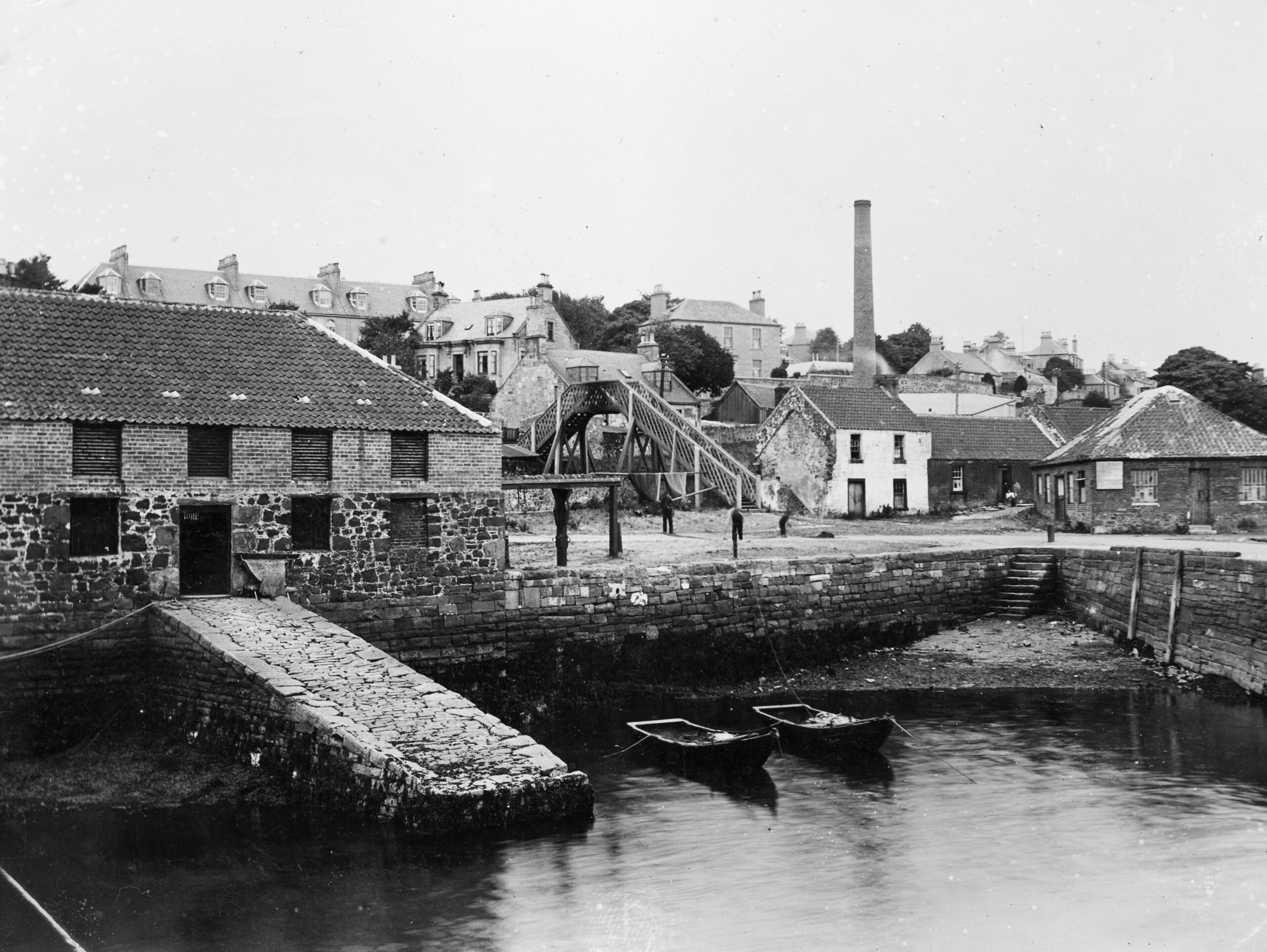
image: Fish house & County Pier with salmon cobles & fishermen sorting their nets
Tayport once had a thriving boat and ship building industry. The 717 ton Strathnairn was the last and largest vessel built at Tayport and was launched on Monday 2nd October 1876 at the yard of the Tay Ship Company, tragically she sank following a collision with a steam vessel in the hours of darkness off Normandy in February 1880.
The size of the shipyard area was considerably reduced by the construction of the Newport Railway in 1879 to link up with the new Rail Bridge at Wormit, however a small boat yard still existed on the site until 1998.
3 The West Common
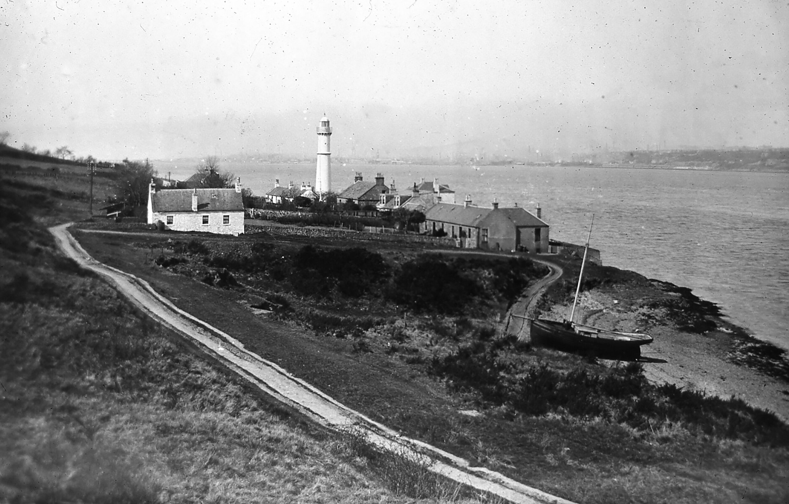
image: West Lights early 1900s
This area of land has had many uses over the years including cattle grazing. Today the Fife Coastal Path passes through with great views out over the River Tay.
4 Ships and Seafarers
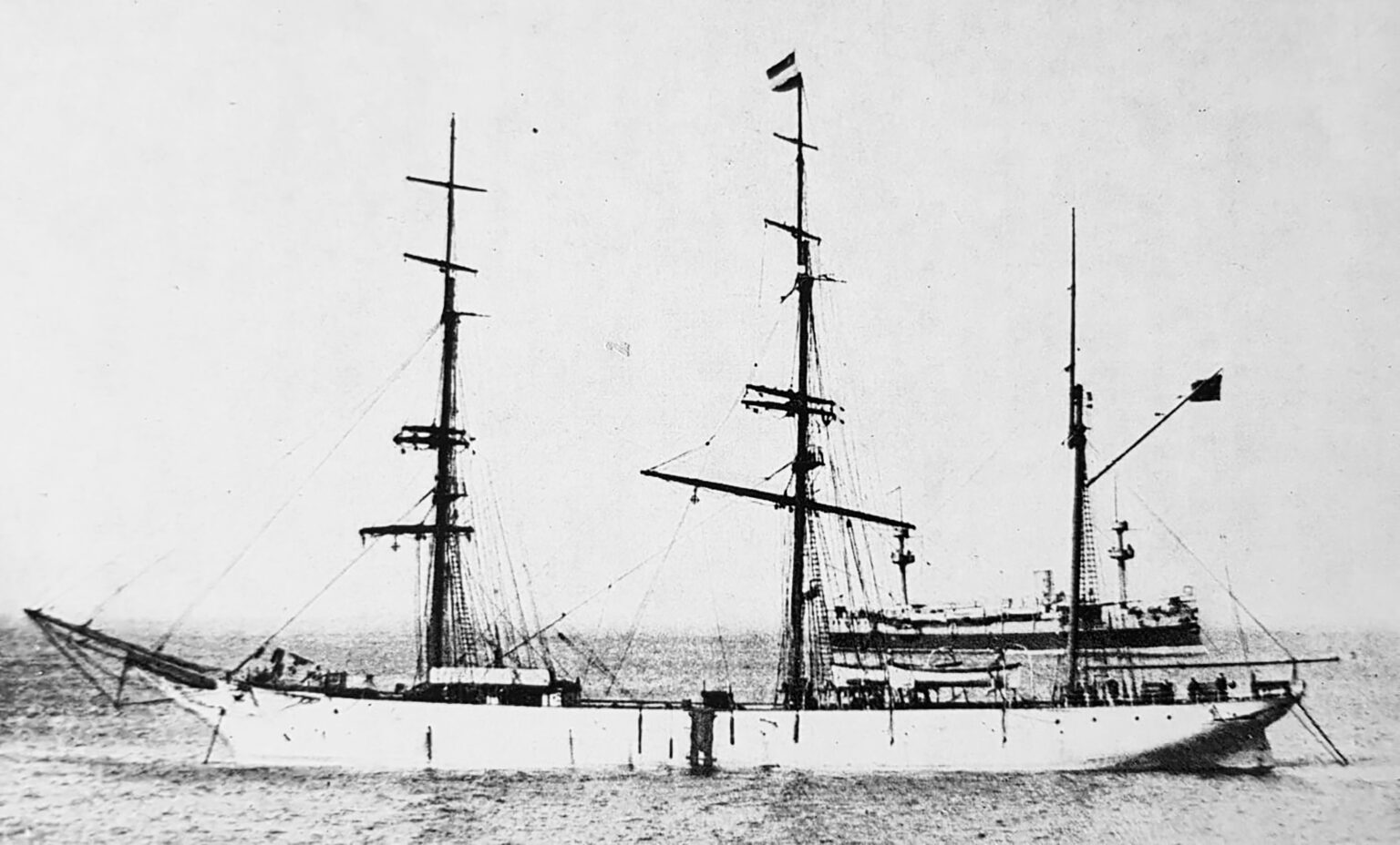
image: The Glenogle
The records show that Tayport sent forth many seafarers and, with its air of quiet prosperity and solidity, attracted many others when their seafaring days were over and the cemetery is the final resting place for many of them. One such seafarer was renowned Tayport mariner, Captain John Pearson who sailed to many places including Australia, America and the Arctic.
Captain Pearson was familiar with many of the visiting vessels to the harbour and also with the grand square-rigged ships which had been built in the local yards, a mere 200 yards from his house.
5 The Castle
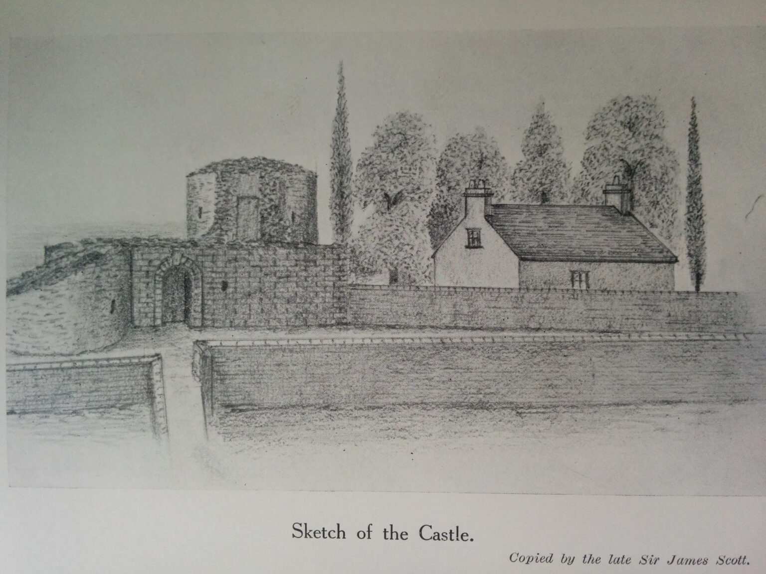
image: Sketch of castle ruin (copied by J Scott 1927)
There is nothing remaining of the castle today but records show that it stood on ground rising up from the Tay, over-looking the entrance to the river opposite Broughty Castle. It was possibly built around 1455 and was one of the most massive examples of the Z plan in Scotland - shaped like a Z, with two circular towers at diagonal corners of a rectangular central block.
6 Art and Satire
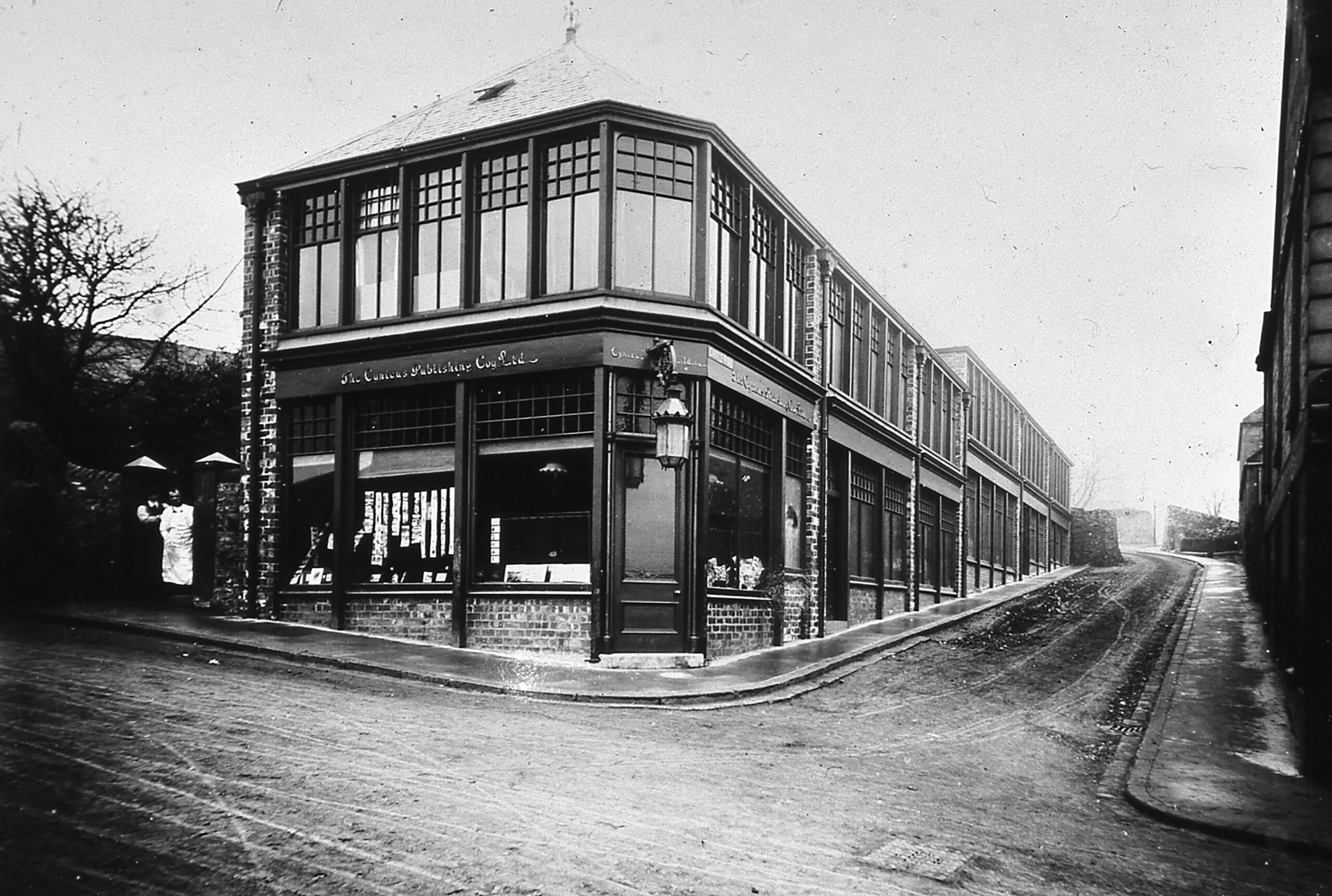
image: Cynicus Printing Works from Broad Street & Castle Road
In the late 19th/early 20th century Tayport was home to a couple of interesting artistic characters. Martin Anderson (1854 – 1932) known by the pen name Cynicus, established the Cynicus Publishing Company in Tayport. He was publisher and designer of the first satirical and humorous postcards. Frank Laing (1862 – 1907) was a Tayport-born artist of some renown. His most famous work is The Yellow Girl’, which he painted in Paris.
7 Spearshill View
image: East Light early 1900s
Navigation of the entrance to the River Tay has always proved challenging under certain conditions. The Craig West Light which you can see from this area is a key navigational aid for the shipping channel, and another structure which provided an early landmark for mariners was the now ruined Waterloo Tower located midway between Tayport and Newport, situated 350 feet up in the woods of Hare Law on Scotscraig Estate. Other past activity in the area includes a prehistoric settlement and the WW1 coastal battery defence location of Spearshill Fort, on the higher ridge line area of the Spears Hill.
8 Ocean Voyages
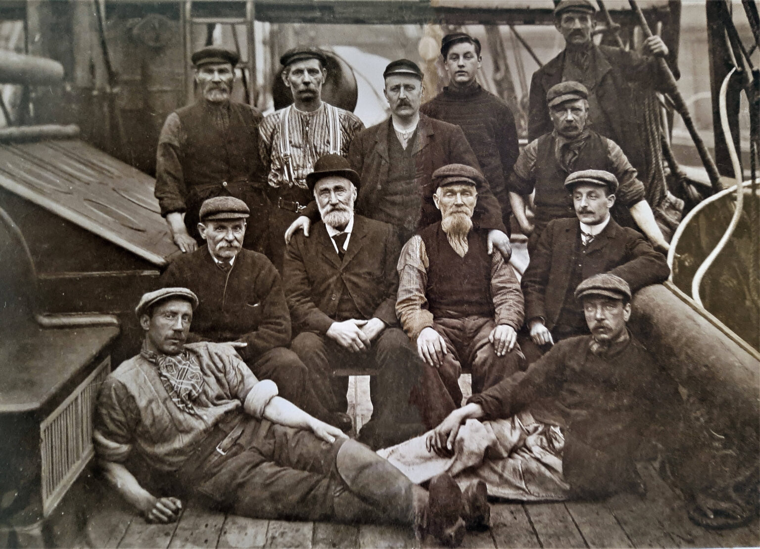
image: Captain Milne with crew on Eclipse
In the 19th and early 20th century seafaring was thriving in Tayport. Local records from 1861 show that about fifty people were engaged in salmon fishing during the season and lists 40 connected with Sea-Faring pursuits, either as Shipowners, Shipmasters or Seamen, and the voters roll of 1880 records 13 shipmasters.
The ships and seamen went far and worldwide including The Arctic and Antarctic.
9 Garden of Remembrance
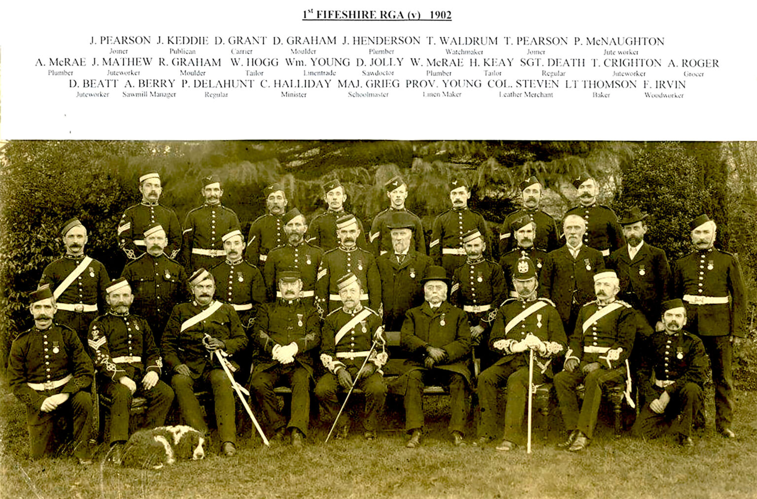
image: Royal Garrison Artillery (v) 1902
The War Memorial was dedicated in 1921 with a further Dedication and Unveiling Ceremony in May 1949, as a lasting memorial to the residents of the parish who made the ultimate sacrifice for their country in times of conflict. As well as local people, the Polish and Norwegian armed forces both had a presence close by during World War II and the RAF Marine Service had an operating base at the harbour from 1940 in support of the nearby aerodrome at R.A.F. Leuchars.
10 Burgh Chambers
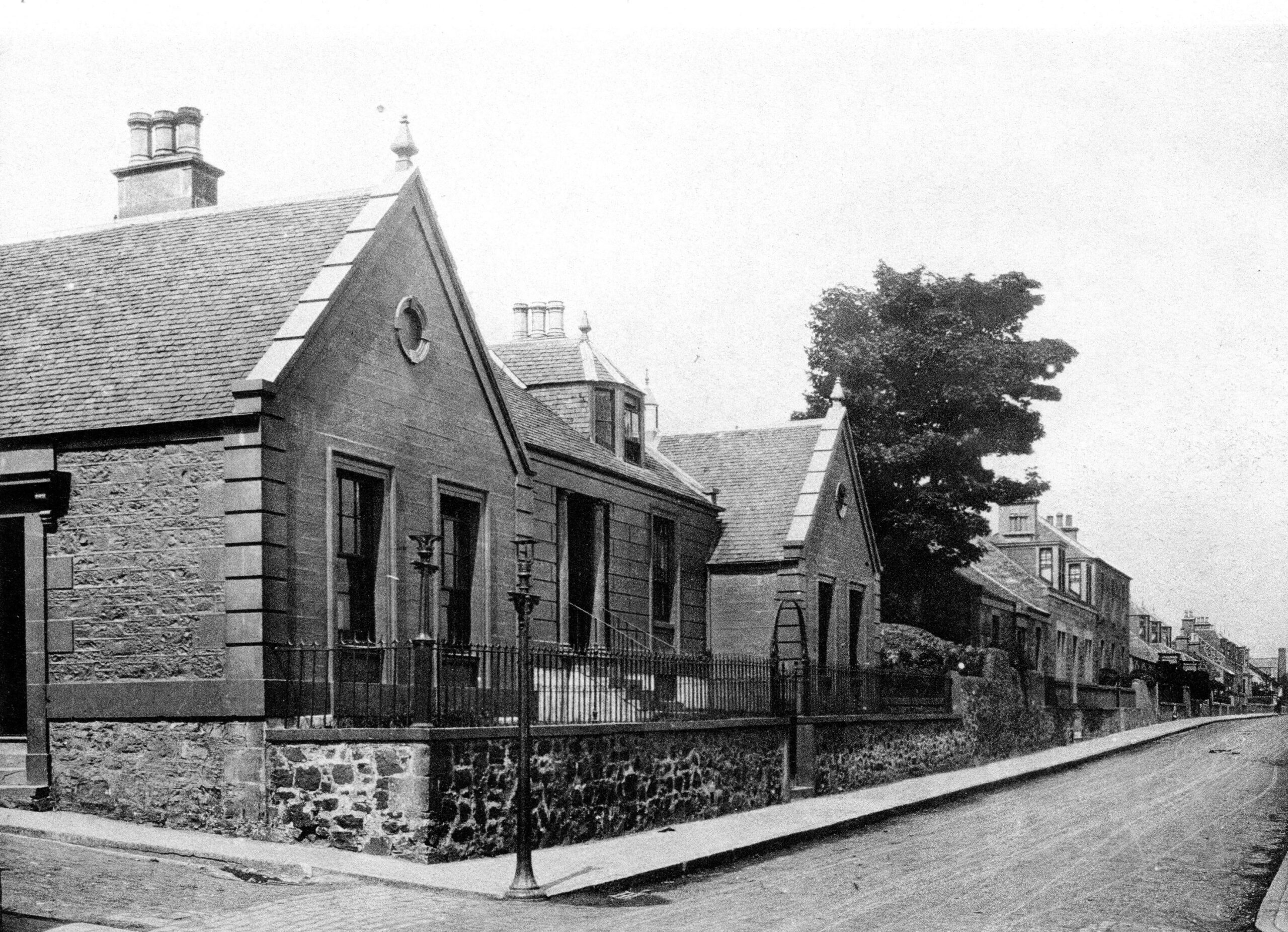
image: Former Burgh Offices in William Street
Tayport Burgh Chambers has several locations over the years to meet the changing demands of the town. Local governance started in the 12th century and the form that takes has has evolved too with the town council losing its powers in 1975 with local government reorganisation. The town council in its various forms oversaw many changes and improvements to the town as it grew and developed.
11 Social Activities
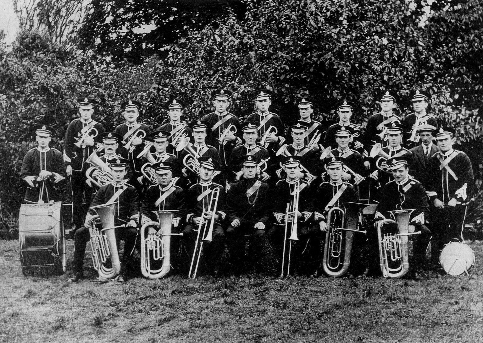
image: Tayport Instrumental Band 1930
Tayport has had a thriving social scene for many years with lots of activites for people to take part in and enjoy. These included Tayport Brass Band, Tayport Instrumental Band, Tayport Dramatic Society, Tayport Choral Society, Tayport Literary Society and Tayport Orchestral Society. Like many towns Tayport had its own cinema which opened in 1931 and closed in 1968.
12 Scotscraig Estate
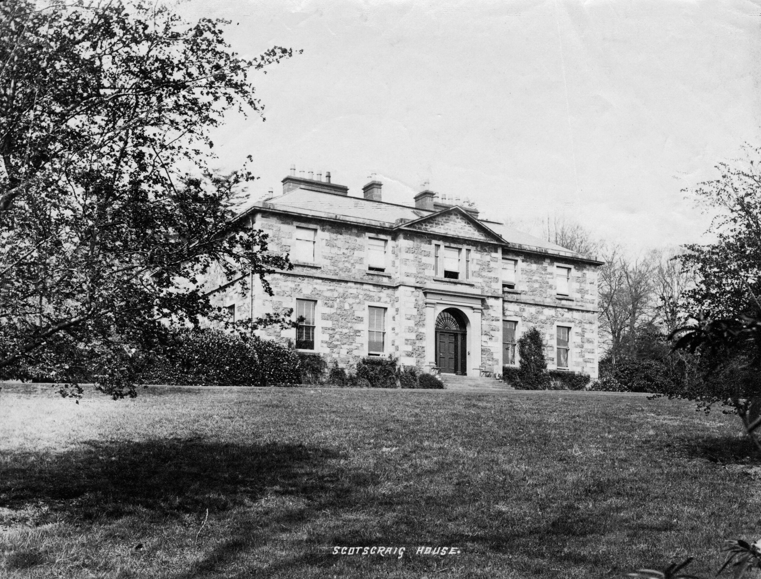
image: Former Scotscraig Mansion built circa 1807 by William Dalgleish and demolished in 1985
The Estate of Scotscraig has an intriguing history and has changed hands many times over the centuries. Scotscraig Estate dates back probably to the 12th century. It was owned in the 13th century by Sir Michael Scott (hence Scott’s Craig). Evidence can still be seen of two Scotscraig mansion houses, the earlier one dates back possibly to as early as the 15th century and in 1806 Robert Dalgleish built the new Scotscraig mansion. In 1918 the estate, rather surprisingly, was bought by the Corporation of Dundee, but much of the estate was sold back to a private owner in 1925. After World War II the house gradually fell into disrepair, and was demolished in the 1980s.
13 The Burn Edge
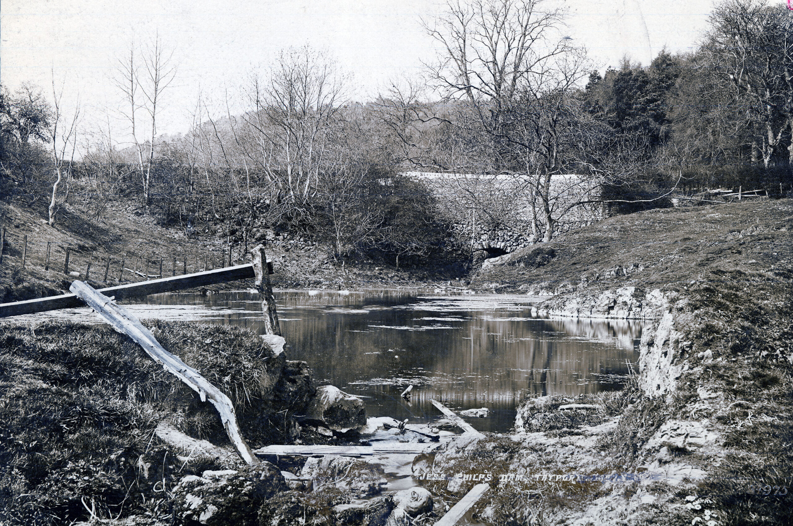
image: Jess Philp’s Dam early 1900s
The Scotscraig Burn flows from an area which was previously a loch before carving a route through several areas of previous prehistoric and medieval agricultural settlements of national importance. It splits at the sluice along Coffin Walk, known locally as the Burn Edge, to transfer water along the lade to the site of the former Mill Dam at Pond Lane. This supplied water power to the sawmill and also filled a boating pond in later years, reaching the river at the Esplanade corner. Coffin Walk may take its name from a nearby 'chapel of ease' (built to serve people who were not close to a church) which was was likely St John’s chapel, first mentioned in 1597.
14 The Curling Pond
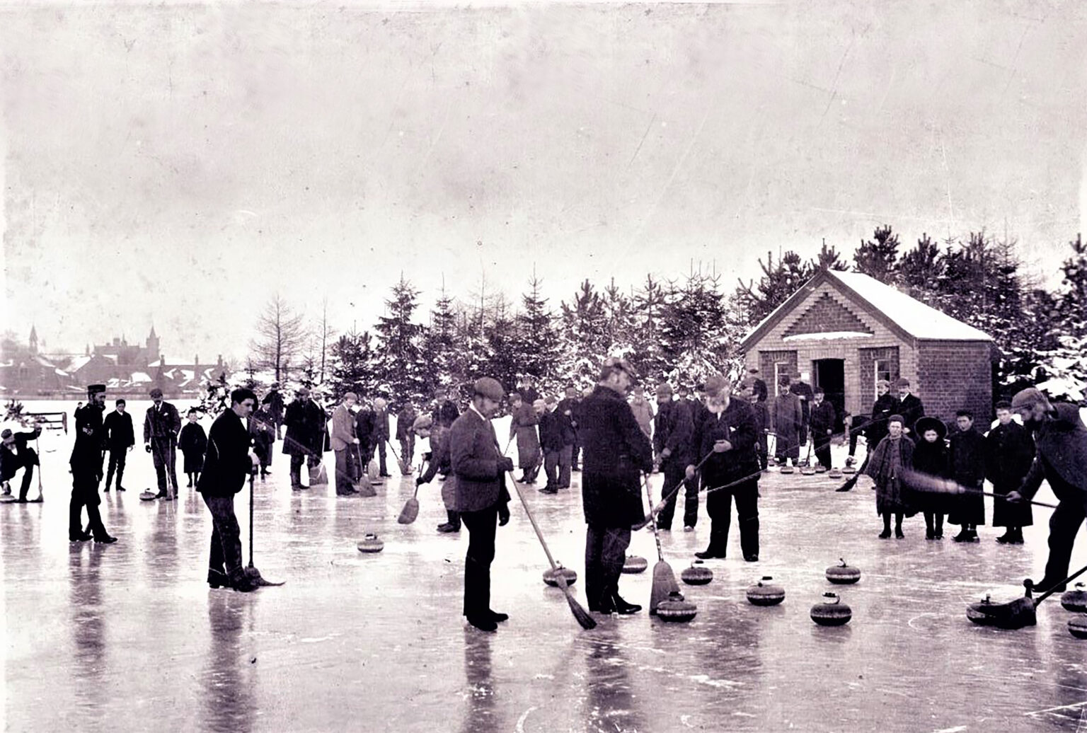
image: Event on the curling pond early 1900s
Scotscraig Curling Club’s history stretched back to 1854 and variously used ponds at Morton Loch, the Garpit Pond on the golf course and at Causewayhead before creating a new curling pond, assisted by the generosity of Admiral Maitland Dougall. In the latter half of the 20th century the curling club’s activities moved to out of town indoor facilities and as a consequence, the curling pond in this location, fell into disrepair. The club itself, as a result of falling membership, was wound up mid 1970s.
15 The Mill Dam Area
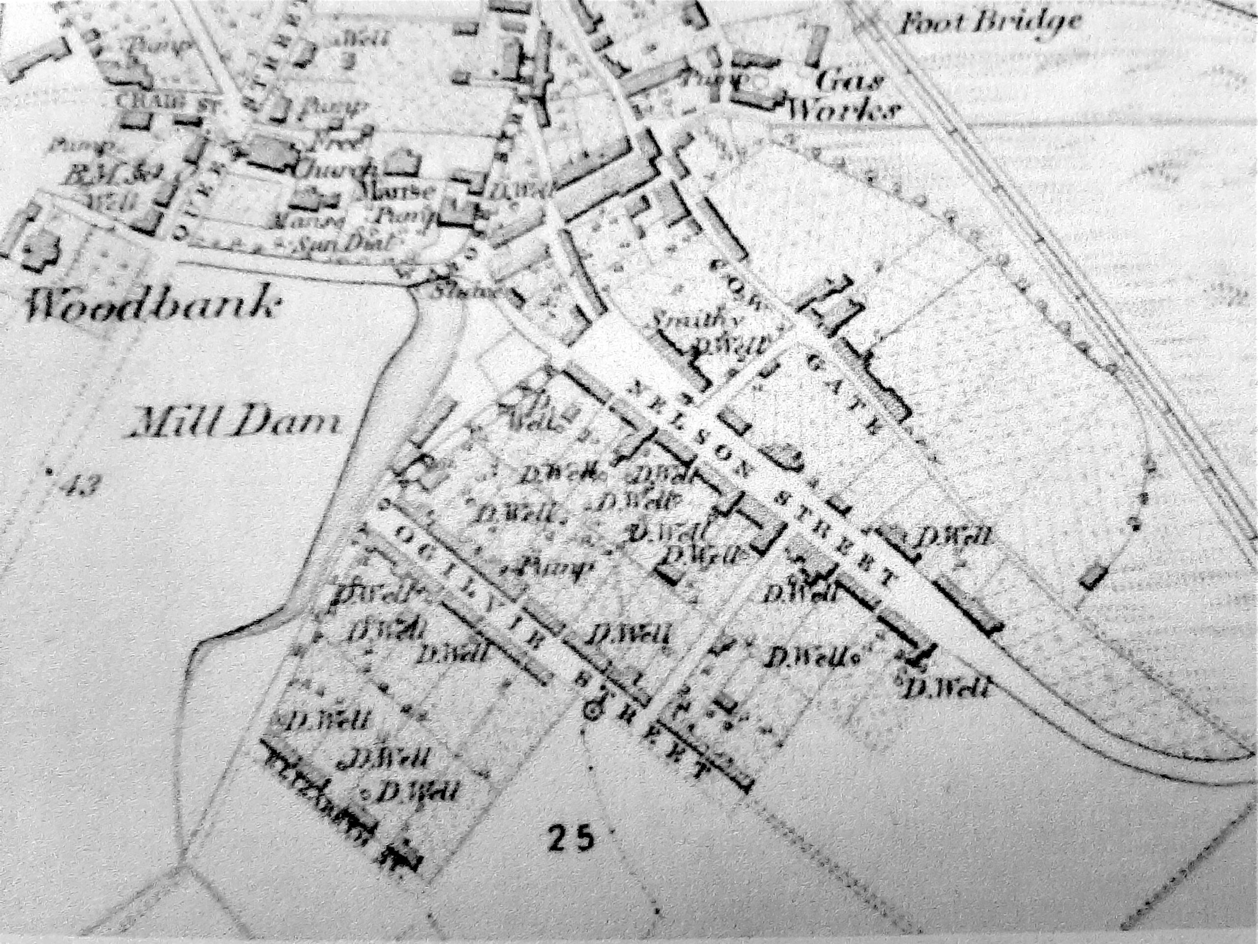
image: 1854 OS map showing Glebe Steading in Rose Street next to Manse. Original Mill Dam extending to Elizabeth Street
The Hope Map of 1769 shows that the Mill Dam was once the end point of the Ferry Town. Until around 1890, what is now Maitland Street was only a lane known as the Watery Bauk, whilst the Dam also continued over Ogilvy Street requiring the use of a footbridge before the formation of the top half of the street. The outlet from the Dam was taken down Mill Lane to help power the sawmill, established in Mill Place by a Mr David Spence in 1850. Before the town water supply was installed in 1890, this water source was also utilised by the Donaldson family, who operated a large sawmill and timber import and supply business at Greenside Place from 1860 until 1990.. The Parochial Directory of 1861 records one of the two sawmills in the town was still driven by water power (Mr Welch) with the other driven by steam (J Donaldson).
16 The Canniepairt
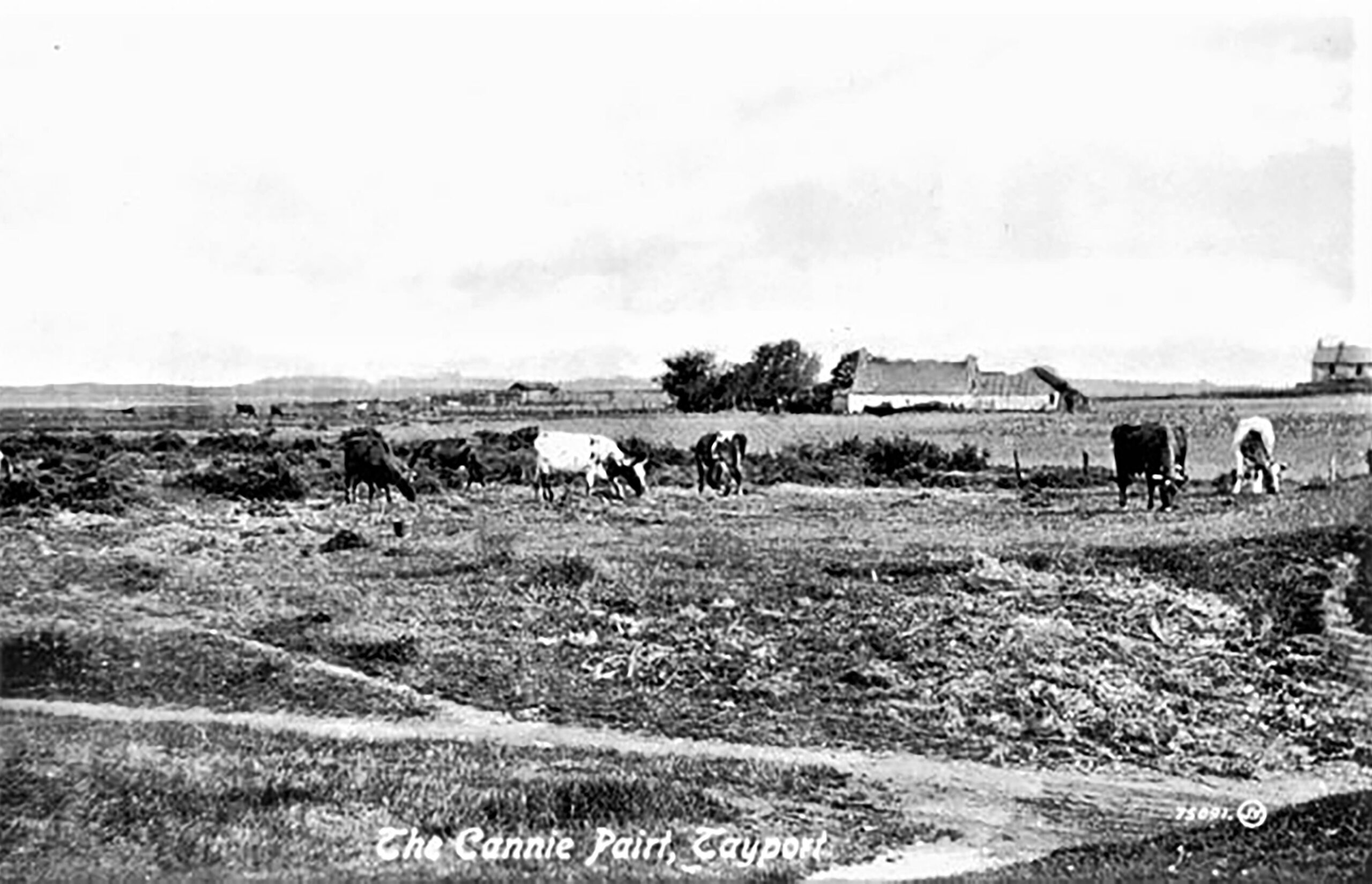
image: The Canniepairt farm from the East Common Plouter
The Canniepairt was once a small farm and it has been the home of Tayport Football club since 1975. With the aid of grant support, a great deal of fundraising and the sterling efforts of committee and townsfolk, they laid out a pitch, built a pavilion and subsequently extending it on several occasions, whilst also erecting fencing, planting trees and building an enclosure. The Club acquired Junior/semi-professional status in 1990 and the efforts were rewarded with unprecedented success, which elevated the town to national prominence through live television broadcasting of six Scottish Junior Cup Finals between 1993 and 2005. Winning on three of those occasions saw Tayport arguably become the top Junior Club in Scotland during that era, with many of the players gaining representative honours at both local and national level as well as a number moving on to Senior Clubs.
17 Garpit Links
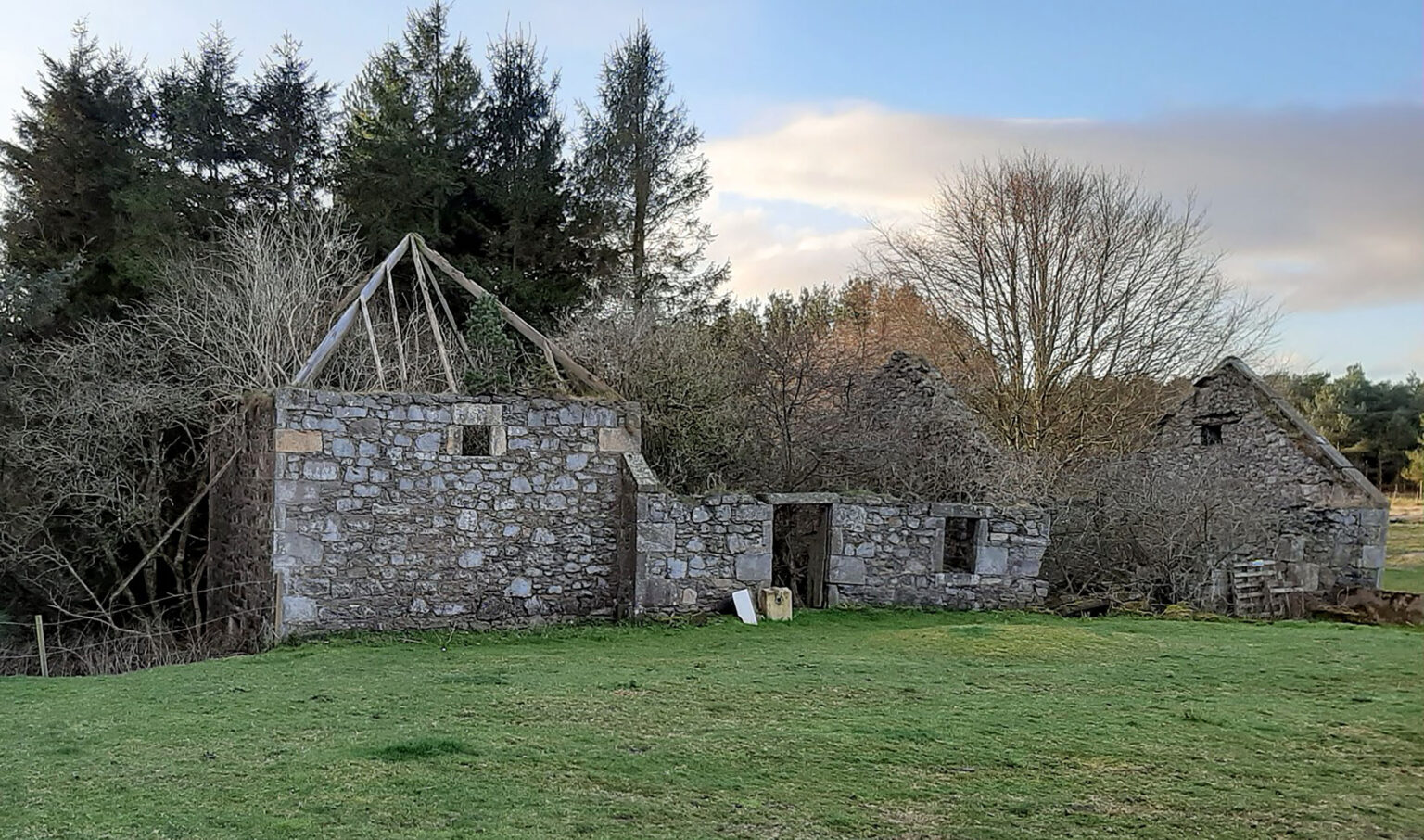
image: Ruin of Ferrie Corn Mill at the Garpit Farm
This area of the town has an ancient history with evidence of Mesolithic settlers near Morton Lochs which were created much later in 1906 by farmer Peter Christie for rearing fish. He diverted the Ninewells Burn which was the water source for the Ferrie Mill (the ruins can still be seen) at Garpit and remained an important supply of water to the steam engines of Scott & Fyfe factory of Tayport until well into the mid 20th century. Scotscraig Golf Club is also in this area and was founded in 1817. A cricket club also existed from at least 1863 and the sport continued to be a key part of the town’s social and sporting activities until the outbreak of WW II.
18 Auld Coup and The Shore
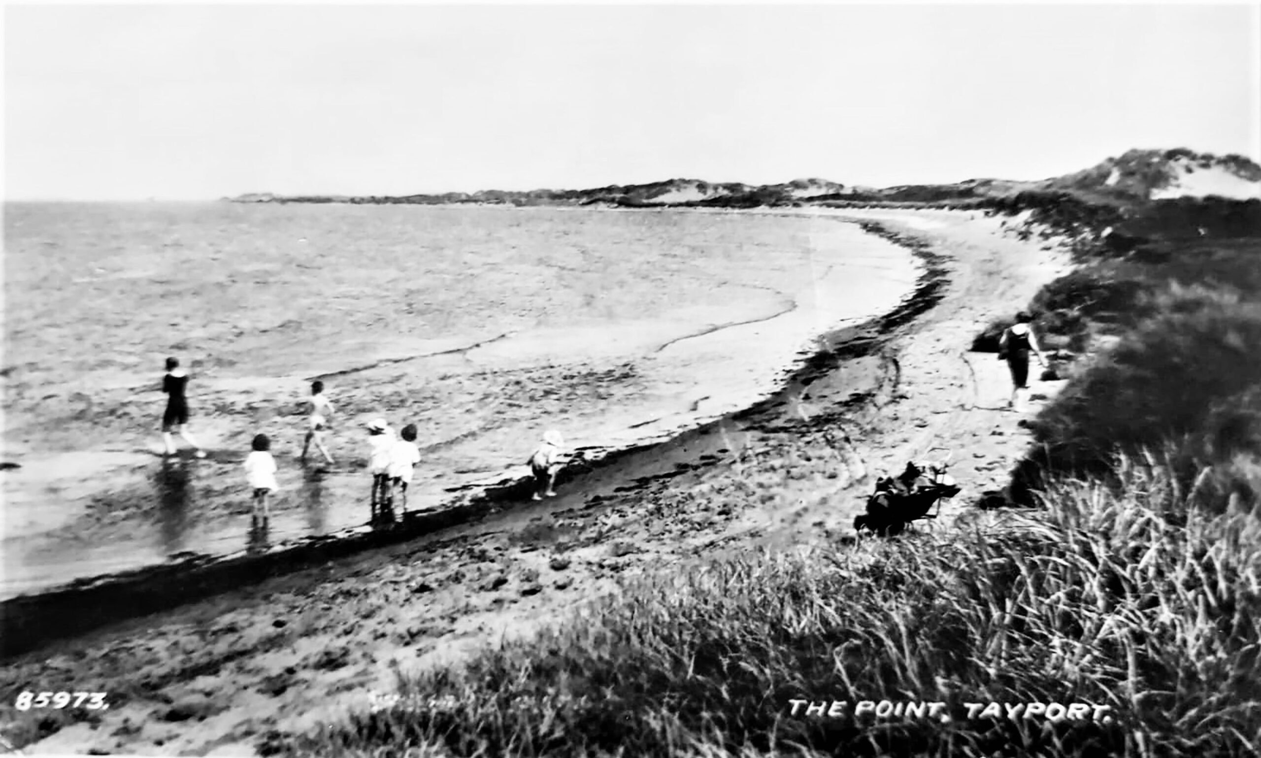
image: Shoreline pre-WWII
World War II brought the threat of invasion on the sandy beaches of Tentsmuir so a system of linear defences was built by the Polish Army between RAF Leuchars and Tayport.The Polish Army had a large presence throughout Fife during the early years of WW II and Polish Camp Road in Tentsmuir and the extensive remains of the beach defences are testimony to their welcome presence.
Many years before this entering the River Tay could be a challenge for the early sailing ships under a combination of adverse weather and tidal conditions. J. S. Neish (1890) relates a story from circa 1840 when a ship was wrecked on the shore near Lucky Scaup with a cargo of wine kegs “ On Lucky there was wine for nought; They say there was a battle fought ………..The church bells rang but few did meet, There was many an empty seat, The people ran with nimble feet, In a hurry for the wine kegs.”
19 Snook Head and Lucky Scalp
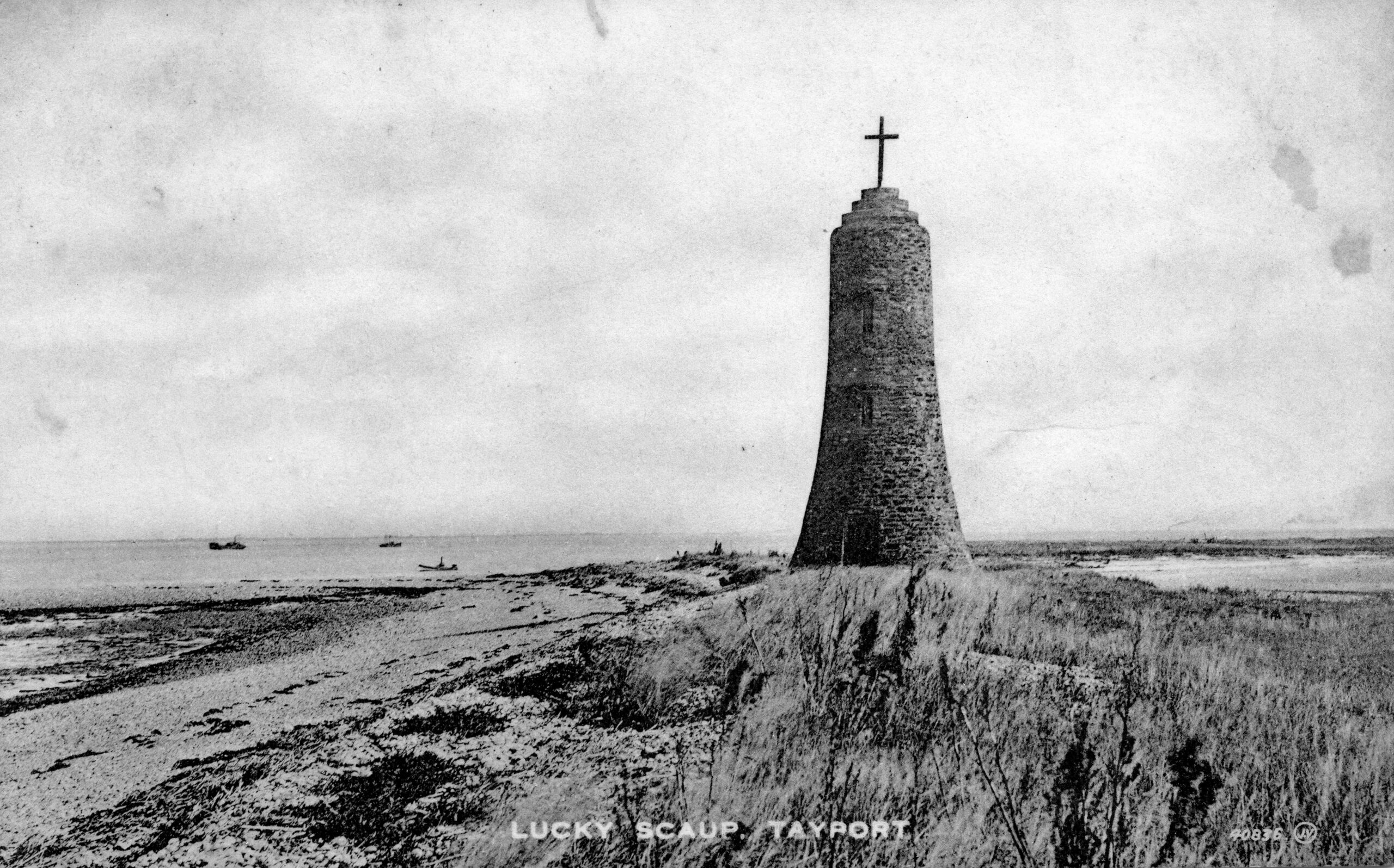
image: Lucky Scalp tower with Navigation Cross and mussel dredger in background
Lucky Scalp is a stony islet probably formed by the dumping of surplus ballast brought down from the Perth area for the ocean going ships moored at Ferry-Port-on-Craig in the 18th & 19th centuries. Lucky Scalp had a significant sandstone tower with a white cross on top, which was a major local landmark for many generations, it was demolished in 1979.
The Battery at nearby Snook Head was used by the Artillery Volunteers and there was a rifle range that saw regular practice in competition for the Scotscraig Medal and other prizes.
20 The Mill Lade
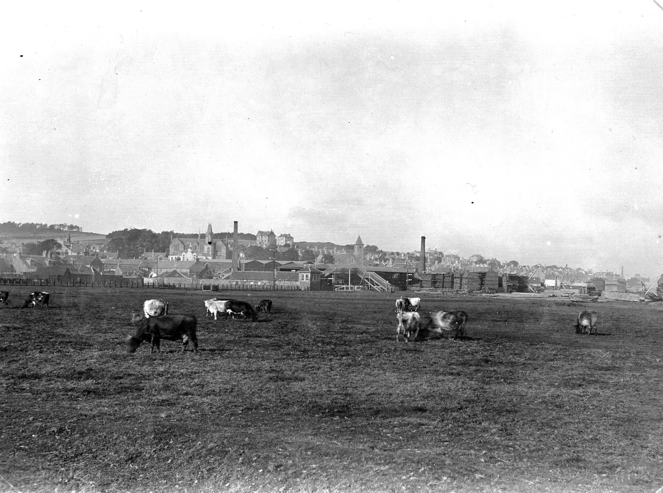
image: Early 1900s cattle on East Common with Donaldson’s woodyard in background
The outlet from the former mill dam still exits at the corner of the Esplanade known locally as the seawall, where it was redirected in 1890 following the construction of a skating pond. Early steam engines often depended on the continuous supply of burn water for their condensers. The continuity of human activity all along the course of the Scotscraig Burn from the location of the former loch at the foot of Archbishop Sharp’s Quarry and the Mill Lade created by the sluice at Coffin Walk, has left an enduring imprint on both the landscape and the town.
21 Musselopolis on The Tay
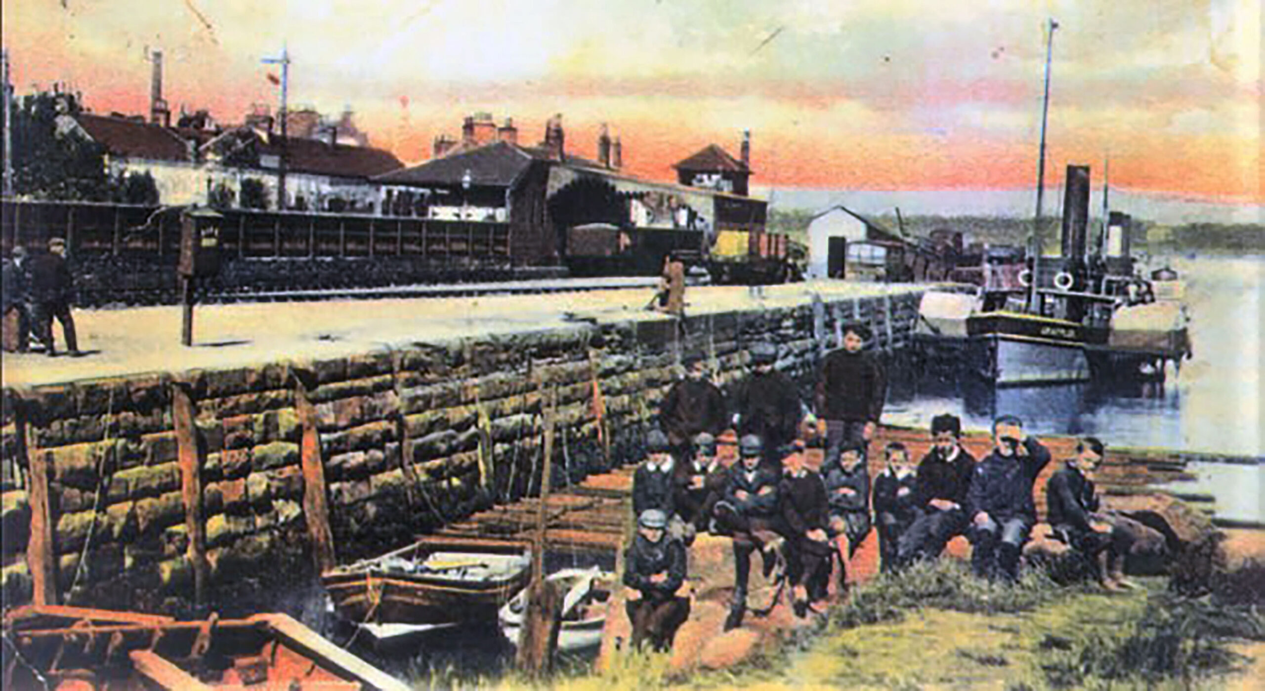
image: Log raft flotation in background ready to transfer around to sawmill beach
The Statistical Account of 1793 highlighted the seasonal employment of harvesting mussels. “On the south side of this part of the Tay, there is a Scalp of a small kind of mussels, esteemed good bait for the white fish; they are purchased for that purpose by the fishermen in the neighbourhood.” This developed into an important industry recognised at national level when on the completion of herring fishing, boats from various parts in the north came to Tayport for their winter store of mussels for baiting their lines. The last commercial boat ceased in the mid 1960s although for a long time afterwards the youngsters fishing on the harbour steps utilised the mussels attached to the seaweed for bait to catch podleys. There was also salmon fishing in the area and whelks were harvested too.
22 The Developing Community

image: Extract from OS 1855 map prior to new public school
This area was at the heart of the developing town in the pre – railway era with dwellings spreading along the lanes towards Cowgate and the East Common, with weavers’ cottages extending down Nelson Street towards the Garpit Links. The town was expanding and along with the formation of the new coast road to Newport in 1830, the development of Castle Street and the spread of properties up the hill by Reform Street, is illustrated by the Scotscraig map of 1831. The disruption within the established church in 1843 and the arrival of the railway in 1848, both had a major influence on the physical and social character of the developing community. The industrialisation which followed in the 1860s brought the development of Donaldson’s major Sawmill operation, which further radically changed the area. The post-railway era and the subsequent changes to the industrial landscape through the closure of the sawmill and cessation of commercial harbour traffic, has seen this area mainly redeveloped for residential use.
23 Auld Kirk and Graveyard
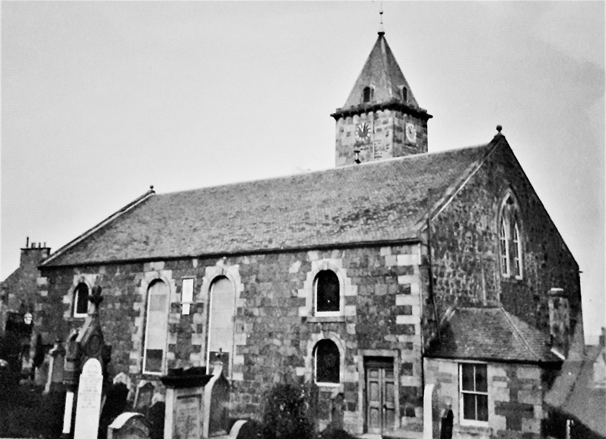
image: Church prior to construction of organ extension in 1890s
The church has been in this location since at least 1607 following the creation of the Parish of Ferry-Port-on-Craig, when the area was disjoined from the Parish of Leuchars in 1602 and was erected by the Scottish Parliament in 1606. The proprietor of Scotscraig in 1606 was Sir John Buchanan and both his initials and those of his wife, Margaret Hartsyde, appear on the wall of the church tower along with both their coat of arms and also of their son-in-law Sir Arthur Erskine. The present church building was erected in 1794 by Rev. Robert Dalgleish in his capacity as Laird. It stopped being used for regular worship when its congregation was amalgamated with the Queen Street congregation in 1978 to form Tayport Parish Church. There are many headstone inscriptions of considerable interest with regard to the heritage of the town in the graveyard.
24 The Railway Harbour
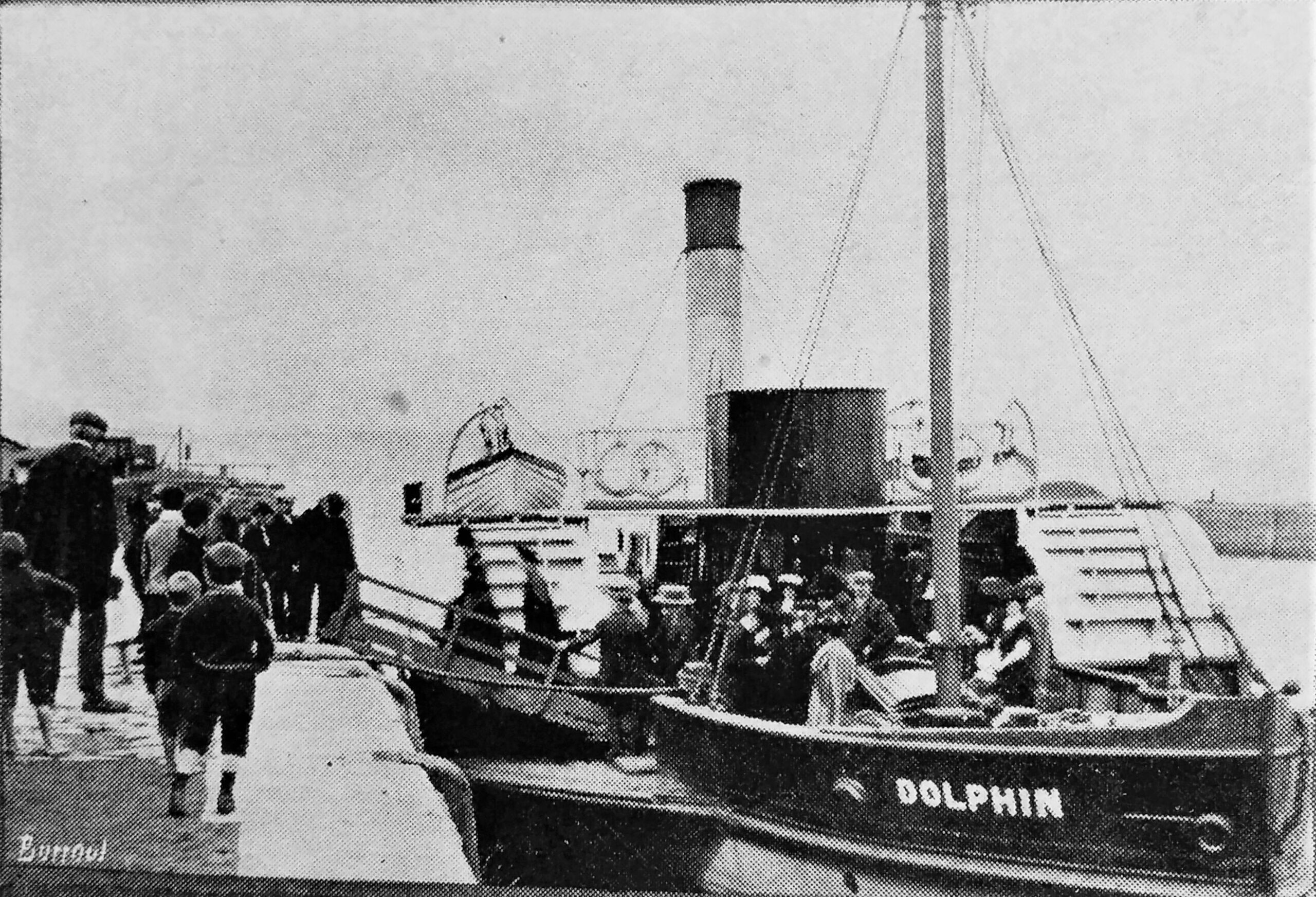
image: Dolphin ferry early 1900s (route operated by John Wilson of Bo’ness 1890 -1920 under lease from NBR)
Before the opening of the Tay Rail Bridge, boat was the only way to cross the river north. The railway reached Ferry-Port-on-Craig in 1848 and the railway company gave notice that goods and livestock could be conveyed across the river on their own steamer the ‘Express ‘ which could accommodate wheeled traffic. The ferry service regained popularity in the period following the collapse of the first Tay Rail Bridge in 1879 and the opening of the replacement bridge at Wormit in June 1887. In 1851 a 'floating railway' service was introduced for cargo. This service was eventually superseded in 1880 following the opening of the first Tay Railway Bridge from Wormit to Dundee in 1878, however the subsequent tragic collapse saw the ‘Robert Napier’ returned from the Forth and continue the wagon crossing service until the new bridge opened in 1887.